
- 682
- 1 561 698
Open Geospatial Solutions
United States
Приєднався 10 лют 2009
Dr. Qiusheng Wu is an Associate Professor in the Department of Geography & Sustainability at the University of Tennessee, Knoxville. In addition, he holds positions as an Amazon Visiting Academic and a Senior Research Fellow at the United Nations University. Specializing in geospatial data science and open-source software development, Dr. Wu is particularly focused on leveraging big geospatial data and cloud computing to study environmental changes, with an emphasis on surface water and wetland inundation dynamics. He is the creator of several open-source packages designed for advanced geospatial analysis and visualization, including geemap, leafmap, and segment-geospatial. For a closer look at his open-source contributions, please visit his GitHub repositories at github.com/opengeos.
Create 3D Maps with Leafmap and Mapbox
Leafmap now supports creating 3D maps with Mapbox and a few lines of python code :earth_americas:
Notebook: leafmap.org/notebooks/94_mapbox
GitHub: github.com/opengeos
leafmap homepage: leafmap.org
geemap homepage: geemap.org
samgeo homepage: samgeo.gishub.org
Twitter: giswqs
UA-cam channel: youtube.com/@giswqs
GEE Tutorials Playlist: gishub.org/youtube-gee
Leafmap Tutorials Playlist: gishub.org/youtube-leafmap
Geographic Software Design Playlist: gishub.org/gsd
Spatial Data Management Playlist: gishub.org/sdm
Переглядів: 366
Відео


Visualize Earth Engine Data in 3D with Leafmap and Mapbox
Переглядів 46214 днів тому
leafmap.org/notebooks/94_mapbox/ GitHub: github.com/opengeos leafmap homepage: leafmap.org geemap homepage: geemap.org samgeo homepage: samgeo.gishub.org Twitter: giswqs UA-cam channel: youtube.com/@giswqs GEE Tutorials Playlist: gishub.org/youtube-gee Leafmap Tutorials Playlist: gishub.org/youtube-leafmap Geographic Software Design Playlist: gishub.org/gsd Spatial Data Management P...

MapLibre Tutorial 14: Create 3D Choropleth Maps
Переглядів 27914 днів тому
Video: ua-cam.com/video/RIUAph8TEA0/v-deo.html Playlist: bit.ly/maplibre Notebook: leafmap.org/maplibre/3d_choropleth Demo: maps.gishub.org/maplibre/3d_choropleth.html GitHub: github.com/opengeos leafmap homepage: leafmap.org geemap homepage: geemap.org samgeo homepage: samgeo.gishub.org Twitter: giswqs UA-cam channel: youtube.com/@giswqs GEE Tutorials Playlist: gishub.org/youtube-g...

MapLibre Tutorial 13: Visualize Ocean Bathymetry in 3D
Переглядів 37614 днів тому
Video: ua-cam.com/video/SLHwMbZox9o/v-deo.html Playlist: bit.ly/maplibre Notebook: leafmap.org/maplibre/ocean_bathymetry Demo: maps.gishub.org/maplibre/ocean_bathymetry.html GitHub: github.com/opengeos leafmap homepage: leafmap.org geemap homepage: geemap.org samgeo homepage: samgeo.gishub.org Twitter: giswqs UA-cam channel: youtube.com/@giswqs GEE Tutorials Playlist: gishub.org/you...

MapLibre Tutorial 12: Construct 3D Basemaps Using MapTiler
Переглядів 39521 день тому
Video: ua-cam.com/video/9E2ONh2Te8Y/v-deo.html Playlist: bit.ly/maplibre Notebook: leafmap.org/maplibre/3d_style Demo: maps.gishub.org/maplibre/3d_style.html GitHub: github.com/opengeos leafmap homepage: leafmap.org geemap homepage: geemap.org samgeo homepage: samgeo.gishub.org Twitter: giswqs UA-cam channel: youtube.com/@giswqs GEE Tutorials Playlist: gishub.org/youtube-gee Leafmap...

MapLibre Tutorial 11: Visualize Overture Open Buildings in 3D
Переглядів 49721 день тому
Video: ua-cam.com/video/OsFEH3DFstc/v-deo.html Playlist: bit.ly/maplibre Notebook: leafmap.org/maplibre/3d_pmtiles Demo: maps.gishub.org/maplibre/3d_pmtiles.html GitHub: github.com/opengeos leafmap homepage: leafmap.org geemap homepage: geemap.org samgeo homepage: samgeo.gishub.org Twitter: giswqs UA-cam channel: youtube.com/@giswqs GEE Tutorials Playlist: gishub.org/youtube-gee Lea...
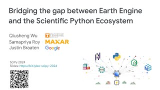
SciPy 2024 Presentation: Bridging the gap between Earth Engine and the Scientific Python Ecosystem
Переглядів 1,2 тис.21 день тому
Video: ua-cam.com/video/YMXFVFpH2yI/v-deo.html Slides: bit.ly/ee-scipy-2024 GitHub: github.com/opengeos leafmap homepage: leafmap.org geemap homepage: geemap.org samgeo homepage: samgeo.gishub.org Twitter: giswqs UA-cam channel: youtube.com/@giswqs GEE Tutorials Playlist: gishub.org/youtube-gee Leafmap Tutorials Playlist: gishub.org/youtube-leafmap Geographic Software Design Playlis...

SciPy 2024 Presentation: Automated Segmentation of Remote Sensing Imagery with Segment-Geospatial
Переглядів 65221 день тому
Slides: bit.ly/samgeo-scipy GitHub: github.com/opengeos leafmap homepage: leafmap.org geemap homepage: geemap.org samgeo homepage: samgeo.gishub.org Twitter: giswqs UA-cam channel: youtube.com/@giswqs GEE Tutorials Playlist: gishub.org/youtube-gee Leafmap Tutorials Playlist: gishub.org/youtube-leafmap Geographic Software Design Playlist: gishub.org/gsd Spatial Data Management Playli...

MapLibre Tutorial 10: Display GIF Animations on an Interactive Map
Переглядів 22428 днів тому
Video: ua-cam.com/video/wzS7Xaepuvc/v-deo.html Playlist: bit.ly/maplibre Notebook: leafmap.org/maplibre/add_gif Demo: maps.gishub.org/demos/hyperloop.html GitHub: github.com/opengeos leafmap homepage: leafmap.org geemap homepage: geemap.org samgeo homepage: samgeo.gishub.org Twitter: giswqs UA-cam channel: youtube.com/@giswqs GEE Tutorials Playlist: gishub.org/youtube-gee Leafmap Tu...
Image Segmentation and Remote Sensing | Segment Anything Geospatial
Переглядів 1,6 тис.28 днів тому
Slides: bit.ly/samgeo-meta GitHub: github.com/opengeos leafmap homepage: leafmap.org geemap homepage: geemap.org samgeo homepage: samgeo.gishub.org Twitter: giswqs UA-cam channel: youtube.com/@giswqs GEE Tutorials Playlist: gishub.org/youtube-gee Leafmap Tutorials Playlist: gishub.org/youtube-leafmap Geographic Software Design Playlist: gishub.org/gsd Spatial Data Management Playlis...
MapLibre Tutorial 09: Display Videos on an Interactive Map
Переглядів 44628 днів тому
Video: ua-cam.com/video/Rnbr0-kuVws/v-deo.html Playlist: bit.ly/maplibre Notebook: leafmap.org/maplibre/video_on_a_map Demo: maps.gishub.org/maplibre/video_on_a_map.html GitHub: github.com/opengeos leafmap homepage: leafmap.org geemap homepage: geemap.org samgeo homepage: samgeo.gishub.org Twitter: giswqs UA-cam channel: youtube.com/@giswqs GEE Tutorials Playlist: gishub.org/youtube...
MapLibre Tutorial 08: Visualize Google Earth Engine Data in 3D
Переглядів 723Місяць тому
Playlist: bit.ly/maplibre Notebook: leafmap.org/maplibre/google_earth_engine Demo: maps.gishub.org GitHub: github.com/opengeos leafmap homepage: leafmap.org geemap homepage: geemap.org samgeo homepage: samgeo.gishub.org Twitter: giswqs UA-cam channel: youtube.com/@giswqs GEE Tutorials Playlist: gishub.org/youtube-gee Leafmap Tutorials Playlist: gishub.org/youtube-leafmap Geographic ...
MapLibre Tutorial 07: Visualize Real-time Movement Data in 3D
Переглядів 515Місяць тому
Video: bit.ly/maplibre Notebook: leafmap.org/maplibre/live_update_feature Demo: maps.gishub.org GitHub: github.com/opengeos leafmap homepage: leafmap.org geemap homepage: geemap.org samgeo homepage: samgeo.gishub.org Twitter: giswqs UA-cam channel: youtube.com/@giswqs GEE Tutorials Playlist: gishub.org/youtube-gee Leafmap Tutorials Playlist: gishub.org/youtube-leafmap Geographic Sof...
MapLibre Tutorial 06: Export 3D Maps as HTML Files for Website Hosting
Переглядів 262Місяць тому
Video: bit.ly/maplibre Notebook: leafmap.org/maplibre/to_html Demo: maps.gishub.org GitHub: github.com/opengeos leafmap homepage: leafmap.org geemap homepage: geemap.org samgeo homepage: samgeo.gishub.org Twitter: giswqs UA-cam channel: youtube.com/@giswqs GEE Tutorials Playlist: gishub.org/youtube-gee Leafmap Tutorials Playlist: gishub.org/youtube-leafmap Geographic Software Design...
MapLibre Tutorial 05: Extrude Polygons for 3D Indoor Mapping
Переглядів 225Місяць тому
Video: bit.ly/maplibre Notebook: leafmap.org/maplibre/3d_indoor_mapping Demo: maps.gishub.org/maplibre/3d_indoor_mapping.html GitHub: github.com/opengeos leafmap homepage: leafmap.org geemap homepage: geemap.org samgeo homepage: samgeo.gishub.org Twitter: giswqs UA-cam channel: youtube.com/@giswqs GEE Tutorials Playlist: gishub.org/youtube-gee Leafmap Tutorials Playlist: gishub.org/...
MapLibre Tutorial 04: Display Buildings in 3D
Переглядів 342Місяць тому
MapLibre Tutorial 04: Display Buildings in 3D
MapLibre Tutorial 03: Display Layers on a 3D Terrain
Переглядів 757Місяць тому
MapLibre Tutorial 03: Display Layers on a 3D Terrain
MapLibre Tutorial 02: Use Basemaps from MapTiler and XYZservices
Переглядів 436Місяць тому
MapLibre Tutorial 02: Use Basemaps from MapTiler and XYZservices
MapLibre Tutorial 01: An Introduction to MapLibre and MapTiler
Переглядів 1,5 тис.Місяць тому
MapLibre Tutorial 01: An Introduction to MapLibre and MapTiler
Bring your maps to life with 3D building and animated GIFs
Переглядів 252Місяць тому
Bring your maps to life with 3D building and animated GIFs
Bring your maps to life with 3D buildings and animated GIFs
Переглядів 130Місяць тому
Bring your maps to life with 3D buildings and animated GIFs
Display a video on an interactive map with MapLibre and Leafmap
Переглядів 323Місяць тому
Display a video on an interactive map with MapLibre and Leafmap
Visualize Earth Engine Data in 3D with Leafmap and MapLibre
Переглядів 563Місяць тому
Visualize Earth Engine Data in 3D with Leafmap and MapLibre
Draw features interactively on 2D and 3D maps with Leafmap and MapLibre
Переглядів 286Місяць тому
Draw features interactively on 2D and 3D maps with Leafmap and MapLibre
Visualize timeseries of ERA5 temperature data in 3D with PyVista and HyperCoast
Переглядів 336Місяць тому
Visualize timeseries of ERA5 temperature data in 3D with PyVista and HyperCoast
Creating marker clusters and heatmaps with Leafmap and MapLibre
Переглядів 258Місяць тому
Creating marker clusters and heatmaps with Leafmap and MapLibre
60 Notebook Examples for Interactive 3D Mapping with MapLibre and Leafmap
Переглядів 599Місяць тому
60 Notebook Examples for Interactive 3D Mapping with MapLibre and Leafmap
Animate a point along a route with Leafmap and MapLibre
Переглядів 241Місяць тому
Animate a point along a route with Leafmap and MapLibre
Visualizing realtime movement data in 3D with Leafmap and MapLibre
Переглядів 534Місяць тому
Visualizing realtime movement data in 3D with Leafmap and MapLibre
Visualizing terrain in 3D with Leafmap and MapLibre
Переглядів 333Місяць тому
Visualizing terrain in 3D with Leafmap and MapLibre
Kindly fulfill the gaps which is tech logy based Innovative methods are not explored We expect share the knowledge
Hi professor wu This method succeed or R&D level Can you please let we know
Thanks for the HD Sir
Sir please make video on finding dumpsite for solid waste management in Google Earth Engine
Why not using docker-compose?
Which operating system you are using ?
Manjaro KDE
did you do it for free?
Hi Dr. Wu, Thank you so much for your efforts! I was trying out your package with MapLibre and encountered an issue. Specifically, using m.fit_bounds or leafmap.Map(center=[latitude, longitude], zoom=16, pitch=45, bearing=-17, style="basic-v2") didn't work properly for coordinates in Europe. For example, with the coordinates for Paris (48.8566, 2.3522), the map didn't display correctly. For your information, I'm using this within a Streamlit application. Could you please advise on how to resolve this issue? Thanks a lot
When using pitch and bearing, the bounds is not a rectangle. As a result, the fit bounds method may not work properly
Very nice and informative tutorial. I have one question regarding the activation of Whitebox Toolset Extension for ArcGIS front-end. I am purchasing a license for Whitebox Toolset Extension (WTE) from Whitebox Geospatial Inc. I am intending to use it in ArcMap 10.8 version. Could you kindly tell me how I activate the WTE license to be used in Whitebox Toolbox ArcMap front-end?
thank you from allah
Nice video, May i create my own dataset & model for samgeo? especially for building footprint, because there is some different pattern of a roof in my country. Thank you
m = leafmap.Map(center=[-100, 40], zoom=3) m.add_basemap("Google Hybrid", opacity=1 , visible=False) m.add_basemap("OpenTopoMap") m.add_layer_control() m I tried this script in Colab and it shows a layer option on the map but when click on the layer option the map just disappears and shows "localhost refused to connect." Other steps were running very nicely.
great job, i have a question,is there a way to show (filter) the buildings (provided by google and microsft) with your GLC-FCS30D service per year
❤❤ código
I get SSL Error( Can't connect to HTTPS URL because the SSL module is not available)
at 9:25 when running the subsequent 'ALTER' table commands for converting id/lat/longs the presenter forgot to change the "USING {{column_name}::integer". As a result he ends up using the population values in the other columns rather than the proper fields. In order to fix it you need to delete the table and start over (correct data has been overwritten) then run: ALTER TABLE cities ALTER COLUMN "id" TYPE INT USING "id"::integer; ALTER TABLE cities ALTER COLUMN latitude TYPE FLOAT USING latitude::float; ALTER TABLE cities ALTER COLUMN longitude TYPE FLOAT USING longitude::float; (not sure if floats have enough precision here for lat-longs perhaps double precision would make more sense) Other than that amazing series of tutorials
Sir, I am requesting Coastal Vunerability map using GEE ?? please
Content and software is excellent, I believe it would be worthwhile to reupload this with another new voiceover. Great work, hope to meet you eventually!
Hope SciPy will release the official recording soon
Hi! Thanks for that awesome work you did! One question, its possible make linkedmap or splitmap like in vanilla leafmap with maplibre? (My 2 previous comments vanished, so I comment again... Sorry If I'm flooding)
The best awesome person
Hi! That feature works with leafmap+maplibre too?
Having trouble with launching the Jupyter Notebook on a m3 MacBook Pro using terminal. I get this error AttributeError: partially initialized module 'charset_normalizer' has no attribute 'md__mypyc' (most likely due to a circular import)" Any thoughts appreciated.
In all these examples you show, is there a way we can use a df that has address data with lon+lat and colour the buildings based on energy efficiency A-G?
why is it that the env is saved to C:Users\Ahza Studio\AppData\Local\ESRI\conda\envs\ instead of to C:Program Files\ArcGISPro\bin\Python\envs\ What's wrong, sir?
Simply run your python command prompt as an administrator by going to Start>ArcGIS>Python Command Prompt. Right click and select more (Run as administrator). After running you should see that your new cloned env is saved to C:Program Files\ArcGISPro\bin\Python\envs\.
Thank you sir
How can I model underground water in my area of interest??? ❤❤
the audio is very bad,
Sorry, the conference setup is not very good. The computer mic does not capture the voice very well due to distance
This is unfortunately, thanks for trying
Thank you for the presentation Prof. Like your previous detailed step-by-step training tutorials, is there any on this subject?
how can i do time series analysis and put it on map as line animation
So can you do tutorial for blender and maplibre? I would like to do simple terrain map in blender
How can i access to this layer and having it i a tif or vector format?
Thanks Prof for what you've done. I would like to know if it's possible to use MapLibre with Qgis. I mean to display 3D data from Qgis.
Those videos are more than helpful, thank you very much❤.
NOTEBOOK first cell should be: !pip install leafmap[maplibre]==0.35.9
Sir, salt water intrusion mapping using remote sensing
Agree
Thanks
Great tutorial! Can we alao use it for multi bands Landsat images?
thanks for sharing, great resource Doctor.
Dr. Wu, when I point to the search icon and tool bar on the map, I do not see the options. Please what do I do?
Thanks for uploading this video ❤. I have a project to make 1 kilo by 1kilo map picture and it have to be zoomable I searched a lot but no luck also we need to print the maps grid by grid after design the kml file. Can you help me with this project please.
hi sir, how can i visualize a 3d buildings from my geojson file and integrate this map into my react application?
hi sir, how can i get this interface to work on it?
只能用Mapleaf和MapLibre吗?GEEMAP不考虑增强3D功能?
can we use it with geodjango??
You can export the map as HTML files and use any web framework to host it
Dr. Wu, Thank you for uploading these videos. I learned of you from your appearances on The MapScaping Podcast. A question to you: is it possible to define altitude to some of these points? I'd like to see if you can look at something like aircraft tracks using this method. Thank you again for your incredible videos. - Matt
Yes, it is possible to get altitude from other DEM sources. Maybe I can make another tutorial on that
These are cool stuff Dr. Quisheng. Thank you
Not available for India😢
Magnífico¡¡
fascinating... so damn cool...
Very difficult in Colab...